Services
Make better business decisions
with data-driven insights.
bigfoot Drones:
Cutting-edge aerial imagery solutions
Bigfoot Drones captures real-time information and data using state-of-the-art drone technology while complying with safety rules in all airspace.
Operating Transport Canada certified drone equipment, we supply various Canadian industries with reliable and comprehensive data and analyses using aerial surveying and thermal imaging services and 3D imaging technology.

Bigfoot Drones Services
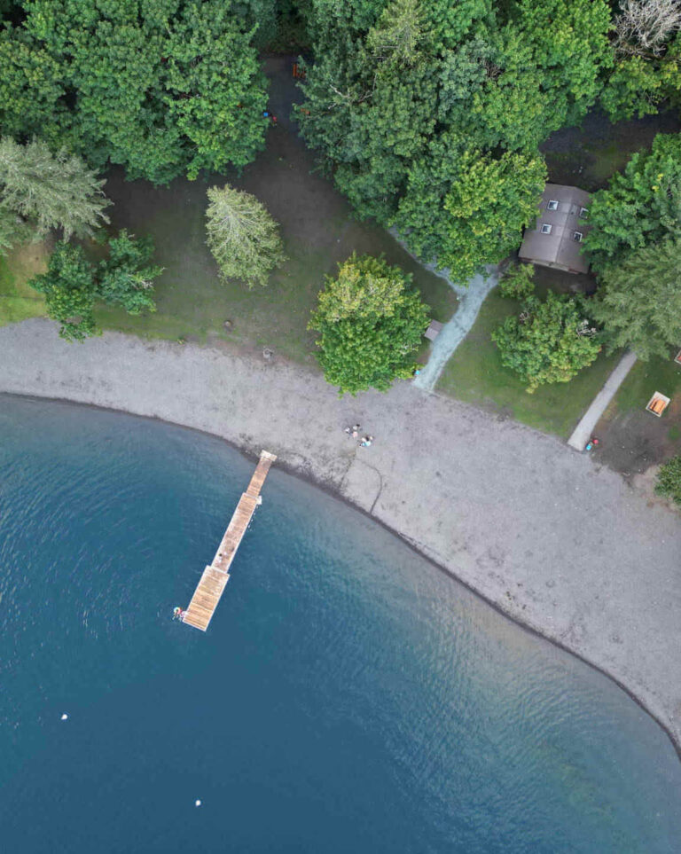
Photogrammetry and Orthomosaic Imaging | Mapping
Drones capture multiple orthophotos over an area using two different vantage points. With advanced mapping software, the overlapping orthophotos are stitched together using a process called photogrammetry to produce an orthomosaic map.
Orthomosaics are high-detail resolutions that are geographically correct and map-quality images to scale.
Detailed aerial imagery can be captured using drone photogrammetry of buildings, landscapes, and energy structures. With reliable and effective solutions, developers, project managers, farmers, and utility companies make informed and cost-effective decisions with data-driven insights.
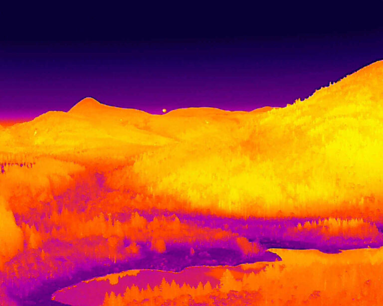
Bigfoot Drones Services
Thermal Imaging and Inspections
Live thermal inspections using drones get safe, fast, and efficient aerial views in a variety of conditions and situations where access may pose health and environmental risks. More importantly, thermal images are current and in real-time capturing critical information.
From engineering and energy industries to construction and manufacturing, Canadian businesses are benefiting from drones performing aerial thermal inspections to identify efficiencies and problem areas. Thermal imaging minimizes maintenance costs providing businesses preventive maintenance without the down time of disrupting normal operations.
Some business applications for drone thermal imaging and inspections include:
- Examining system efficiencies
- Identifying areas of damage
- Evaluating solar fields
- Assessing electrical facilities
- Pinpointing building heat loss
- Inspecting refineries and pipelines
- Scanning for gas and methane leaks

Bigfoot Drones Services
Aerial Photo and Videography
High-definition aerial imagery and quality videography has been transforming the entertainment and travel industry. Our professional drone pilots achieve sweeping aerial and dynamic tracking shots and video: capturing images and footage from challenging angles and heights.
Depending on your industry and project needs, aerial photography and videography is being utilized beyond film. Showcase a real estate property, document a construction site, assess disaster zones to name a few. Get the visualization of your current site conditions. We’re here to help.
Bigfoot Drones Services
Search and Rescue
Getting that perfect angle quickly and accurately in difficult and often treacherous terrain is never more important than in search and rescue (SAR) operations. Time criticality, weather, and terrain are working against SAR volunteers while a missing person is often in a life-threatening situation.
SAR Missions
Aided with Drone Technology
A SAR drone covers a large area in a short period of time and operates in dark, dense areas. Search areas are predominately remote and often inaccessible by vehicle in difficult terrain making access on foot cumbersome and lengthy. With its various sensors and thermal cameras, a SAR drone offers five tools to aid volunteer ground teams:
Response Speed
Ground-based vehicles need roads whereas drones fly in airspace over traffic and avoid obstructions. A drone reaches a location faster and easily navigates inaccessible places, such as remote or hazardous backcountry.
Situational Awareness
Drone photos capture a large area quickly, allowing responders to map the search zone and provide real-time visual information and data.
Detection
Thermal cameras with sensors that detect heat signatures can identify ground objects and humans.
Communication
Equipped with a loudspeaker, communication can be broadcasted to the victim and ground crew via the drone.
Illumination
Thermal cameras with sensors that detect heat signatures can identify ground objects and humans.
Drone technology can aid volunteer SAR teams pinpoint a missing individual and safeguard human rescue teams. For Bigfoot Drones, providing this life-saving service is an important contribution to society.
Ranch Livestock Located with Drone Technology
Checking ranch perimeter fencing remotely for damage or openings using drones is a cost-effective method to keep cattle and horses accountable.
When animals wander off property, drone animal rescues can rapidly be deployed to search and monitor livestock avoiding expensive and time-consuming efforts on the ground. With aerial thermal imagery technology, a drone pilot can identify body heat and pinpoint the animals’ location across fields, in challenging terrains, and during nighttime when there is low visibility.